Outline Maps of Canada and Provinces
Outline maps are always useful, but take a lot of time to find. Here we have a collection of printable maps for your students. We’ve done the legwork – yours to enjoy.


Outline maps are always useful, but take a lot of time to find. Here we have a collection of printable maps for your students. We’ve done the legwork – yours to enjoy.

From west to east, Canada’s six different time zones are: Pacific, Mountain, Central, Eastern, Atlantic and Newfoundland. Up to the 1880s, cities and towns used their own local solar time which could vary from place to place. That was fine when people didn’t travel far, but once the railways allowed quicker travel over long distances,…

Need some suggestions for engaging your children this Canada Day? We’ve compiled a list of themed crafts, activities, and snacks to keep your students having fun this Canada Day! Check them out below. Related Books
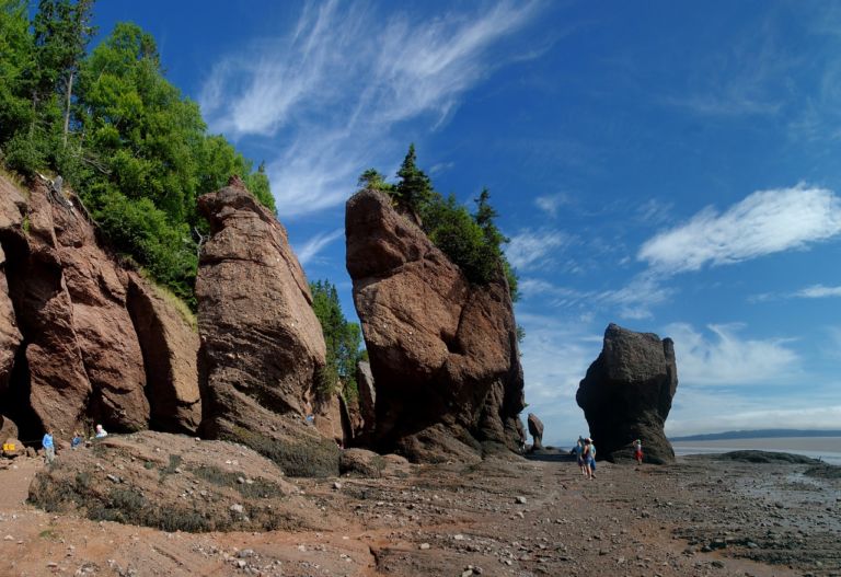
New Brunswick is one of four Atlantic provinces in eastern Canada. New Brunswick is the only officially bilingual province, has the highest tides in the world, and is mostly forested. Historically, ship building and forestry were two of the most important industries. New Brunswick’s terrain is mostly forested uplands, with much of the land further…

🌍 Experience the Excitement of the Geography Fair! The Geography Fair is more than an event—it’s a journey around the world! Students choose a topic that inspires them, whether it’s a country, province, region, or a fascinating global theme. From hands-on research to creative displays, they dive deep into discovery and bring geography to life…
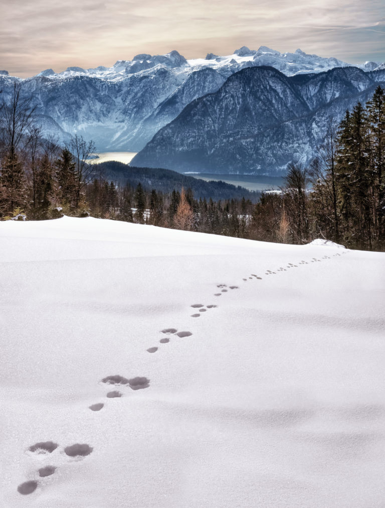
Looking at animal tracks gives children a chance to observe, question, and think critically about what they see. Tracks present a mystery which piques curiosity and begs an answer. Looking for animal tracks is a great opportunity to turn off the devices and enjoy the outdoors while combining science and geography with investigation and inquiry….
Snakes, polar bears and floods… has to be Manitoba! Manitoba is a province at the longitudinal centre of Canada. It is one of the three prairie provinces (with Alberta and Saskatchewan) and Canada’s fifth-most populous province with its estimated 1.3 million people. Manitoba covers 649,950 square kilometres with a widely varied landscape. Manitoba’s capital and…