Outline Maps of Canada and Provinces
Outline maps are always useful, but take a lot of time to find. Here we have a collection of printable maps for your students. We’ve done the legwork – yours to enjoy.


Outline maps are always useful, but take a lot of time to find. Here we have a collection of printable maps for your students. We’ve done the legwork – yours to enjoy.
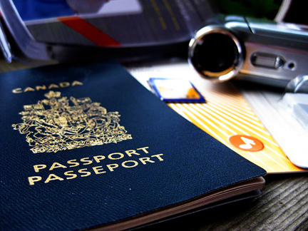
Pretend passports are a great resource to record places you visit throughout the year through studies and books. Whenever you read a story set in a world location, or study another culture, put a sticker or stamp in your passport for a record of all the places you’ve virtually visited. Class or co-op Group Activity: …
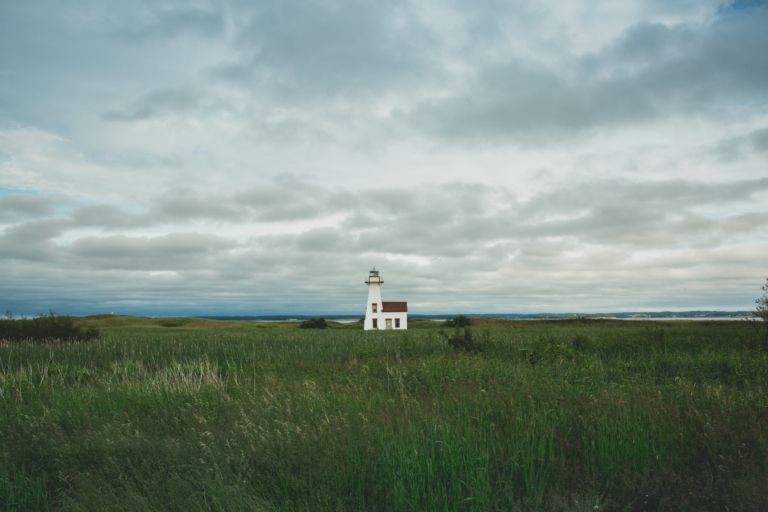
Prince Edward Island is a province and one of the three Maritime Provinces. Maritime means ‘of the sea’. Together, with Newfound and Labrador, these provinces make up the region of Atlantic Canada. PEI is the smallest province of Canada in both land area and population, but it is the most densely populated. The people of…
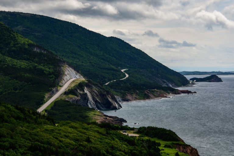
Nova Scotia is one of Canada’s three Maritime Provinces, and one of the four provinces that form Atlantic Canada. Nova Scotia, which includes Cape Breton Island has over 3,800 coastal islands and a whopping 13,000 plus km of coastline. You can see why most of the population lives and works in a coastal community. The sea…
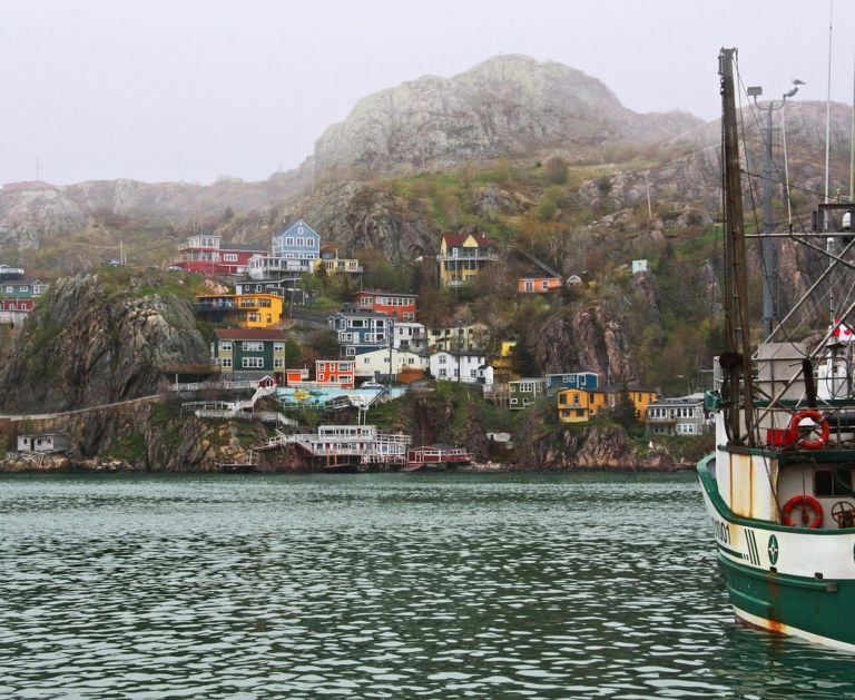
Newfoundland and Labrador is the most easterly province of Canada, closer in fact to Europe, than Canada’s west coast. When the Italian explorer, John Cabot, brought news back to England, the king of England said it was the “New founde lande” and the name stuck. How do locals pronounce the name Newfoundland? See the video below. Labrador is a…

Loyalists who came by land to Quebec and Ontario brought their belongings in covered wagons. Click on the button below for printable craft instructions for a Covered Wagon Craft made with craft supplies around the house. Bonnets – In New France, women and girls wore coifs or caps all the time. Different caps were…

Use these six videos for an introduction to basic geography, measurement of location, latitude and longitude, cartography, and GIS for upper elementary and high school. Related Resources
Lyrics in French (Canadian dialect):
Quand on part des chanquiers
Mes chers amis tous le coeur gai
Pour aller voir tous nos parents
Mes chers amis le coeur content.
Envoyons d’l’avant nos gens
Envoyons d’l’avant!
Mais qu’nos amis nous voyent arriver
Y vont s’mettr’ à rire, à chanter.
Dimanche au soir à la veillée
Nous irons voir nos compagnées.
Dimanche au soir à la veillée
Nous irons voir nos compagnées.
Elles vont nous dire mais en entrant
V’là mon amant, j’ai l’coeur content!
Elles vont nous dire mais en entrant
V’là mon amant, j’ai l’coeur content!
Et au milieu de la veillée
Elles vont nous parler d’leus cavaliers.
Et au milieu de la veillée
Elles vont nous parler d’leurs cavaliers.
Elles vont nous dire mais en partant
As-tu fréquenté des amants?
Elles vont nous dire mais en partant
As-tu fréquenté des amants?
Qui a composé la chanson?
C’est Jos Blanchet le joli garçon!
English translation:
When we leave the chanquiers (woodworking locations)
My dear friends, all with hearts gay,
To see all our friends and family,
My dear friends, all with hearts gay,
Let’s go boys, let’s go!
Let’s go boys, let’s go!
When our friends will see us arrive,
They start laughing and singing,
Sunday night at the vigil,
We’ll go see our partners,
Sunday night at the vigil,
We’ll go see our partners,
They’ll tell us as we enter,
Here’s my lover, my heart is happy,
They’ll tell us as we enter,
Here’s my lover, my heart is happy,
And at the middle of the vigil,
They’ll tell us of their lovers,
And at the middle of the vigil,
They’ll tell us of their lovers,
And they’ll ask us as we leave,
Did you go see any mistresses?
And they’ll ask us as we leave,
Did you go see any mistresses?
Who wrote the song?
It was Jo Blanchet, the pretty boy
Join our newsletter to be the first to get new updates, freebies, and our PDF catalogue to browse.
You can see how this popup was set up in our step-by-step guide: https://wppopupmaker.com/guides/auto-opening-announcement-popups/