Outline Maps of Canada and Provinces
Outline maps are always useful, but take a lot of time to find. Here we have a collection of printable maps for your students. We’ve done the legwork – yours to enjoy.


Outline maps are always useful, but take a lot of time to find. Here we have a collection of printable maps for your students. We’ve done the legwork – yours to enjoy.

Use these six videos for an introduction to basic geography, measurement of location, latitude and longitude, cartography, and GIS for upper elementary and high school. Related Resources
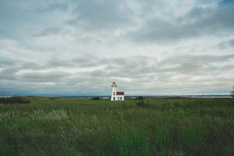
Prince Edward Island is a province and one of the three Maritime Provinces. Maritime means ‘of the sea’. Together, with Newfound and Labrador, these provinces make up the region of Atlantic Canada. PEI is the smallest province of Canada in both land area and population, but it is the most densely populated. The people of…
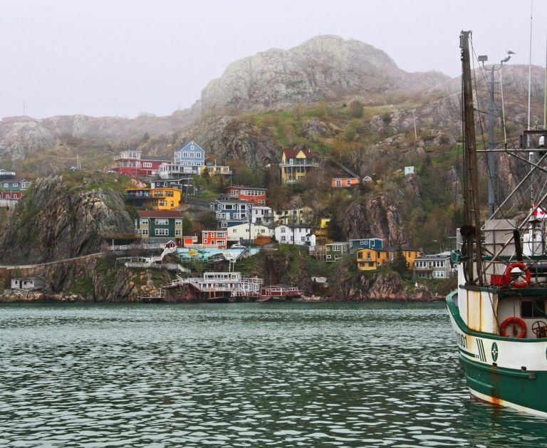
Newfoundland and Labrador is the most easterly province of Canada, closer in fact to Europe, than Canada’s west coast. When the Italian explorer, John Cabot, brought news back to England, the king of England said it was the “New founde lande” and the name stuck. How do locals pronounce the name Newfoundland? See the video below. Labrador is a…
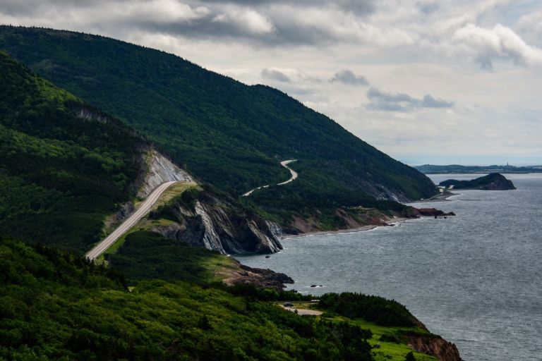
Nova Scotia is one of Canada’s three Maritime Provinces, and one of the four provinces that form Atlantic Canada. Nova Scotia, which includes Cape Breton Island has over 3,800 coastal islands and a whopping 13,000 plus km of coastline. You can see why most of the population lives and works in a coastal community. The sea…
Take a look at the interesting things this prairie province has to offer! Saskatchewan is a prairie and boreal province in western Canada, the only province without a natural border. Saskatchewan is a landlocked province with large distances to moderating bodies of waters. As a result, its climate is extremely continental, rendering severe winters throughout…
Nunavut is the newest, largest, and most northerly territory of Canada. It was separated officially from the Northwest Territories on April 1, 1999. Nunavut comprises a major portion of Northern Canada, and most of the Canadian Arctic Archipelago. Its vast territory makes it the fifth-largest country subdivision in the world, as well as North America’s…
Use these six videos for an introduction to basic geography, measurement of location, latitude and longitude, cartography, and GIS for upper elementary and high school. Related Resources
Prince Edward Island is a province and one of the three Maritime Provinces. Maritime means ‘of the sea’. Together, with Newfound and Labrador, these provinces make up the region of Atlantic Canada. PEI is the smallest province of Canada in both land area and population, but it is the most densely populated. The people of…
Newfoundland and Labrador is the most easterly province of Canada, closer in fact to Europe, than Canada’s west coast. When the Italian explorer, John Cabot, brought news back to England, the king of England said it was the “New founde lande” and the name stuck. How do locals pronounce the name Newfoundland? See the video below. Labrador is a…
Nova Scotia is one of Canada’s three Maritime Provinces, and one of the four provinces that form Atlantic Canada. Nova Scotia, which includes Cape Breton Island has over 3,800 coastal islands and a whopping 13,000 plus km of coastline. You can see why most of the population lives and works in a coastal community. The sea…
Take a look at the interesting things this prairie province has to offer! Saskatchewan is a prairie and boreal province in western Canada, the only province without a natural border. Saskatchewan is a landlocked province with large distances to moderating bodies of waters. As a result, its climate is extremely continental, rendering severe winters throughout…
Nunavut is the newest, largest, and most northerly territory of Canada. It was separated officially from the Northwest Territories on April 1, 1999. Nunavut comprises a major portion of Northern Canada, and most of the Canadian Arctic Archipelago. Its vast territory makes it the fifth-largest country subdivision in the world, as well as North America’s…
Use these six videos for an introduction to basic geography, measurement of location, latitude and longitude, cartography, and GIS for upper elementary and high school. Related Resources
Prince Edward Island is a province and one of the three Maritime Provinces. Maritime means ‘of the sea’. Together, with Newfound and Labrador, these provinces make up the region of Atlantic Canada. PEI is the smallest province of Canada in both land area and population, but it is the most densely populated. The people of…