Outline Maps of Canada and Provinces
Outline maps are always useful, but take a lot of time to find. Here we have a collection of printable maps for your students. We’ve done the legwork – yours to enjoy.


Outline maps are always useful, but take a lot of time to find. Here we have a collection of printable maps for your students. We’ve done the legwork – yours to enjoy.
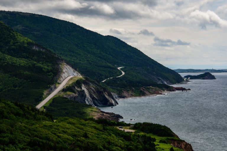
Nova Scotia is one of Canada’s three Maritime Provinces, and one of the four provinces that form Atlantic Canada. Nova Scotia, which includes Cape Breton Island has over 3,800 coastal islands and a whopping 13,000 plus km of coastline. You can see why most of the population lives and works in a coastal community. The sea…
Discover ice planes and bush planes, the wild Nahanni River or the mammoth Wood Buffalo National Park, and top your tour off with a night show of lights. The Northwest Territories is a federal territory of Canada. At a land area of approximately 1,144,000 km2 , it is the second-largest and the most populous of the…
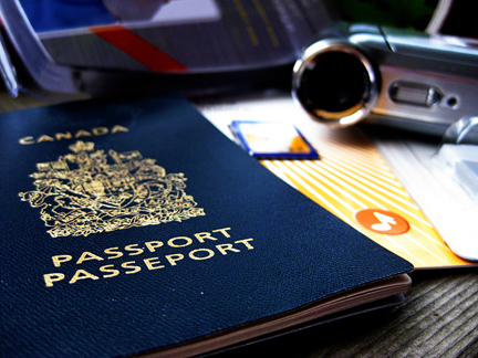
Pretend passports are a great resource to record places you visit throughout the year through studies and books. Whenever you read a story set in a world location, or study another culture, put a sticker or stamp in your passport for a record of all the places you’ve virtually visited. Class or co-op Group Activity: …
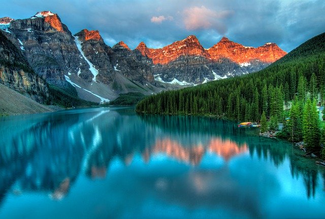
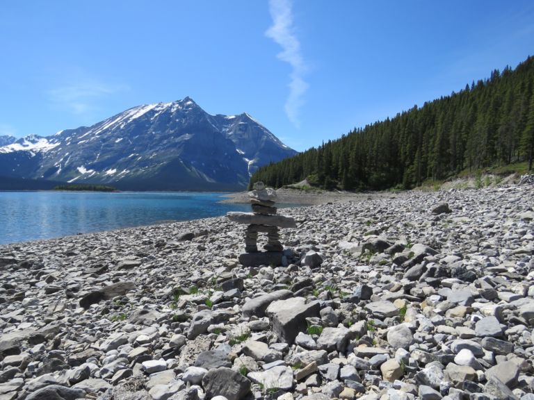
Alberta is a western province of Canada. It is one of only two completely landlocked provinces. It boasts some of the most beautiful locations in Canada, including Banff, and Lake Louise. The 10 day Calgary Stampede is famous around the world. Alberta was named after Princess Louise Caroline Alberta, the fourth daughter of Queen Victoria…
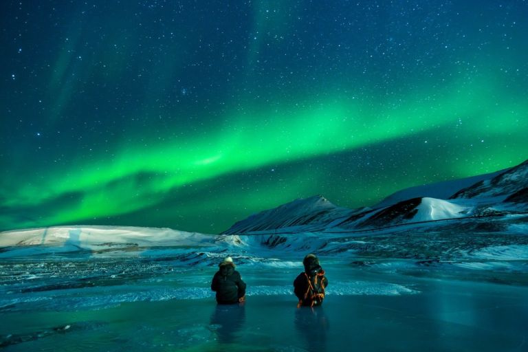
Nunavut is the newest, largest, and most northerly territory of Canada. It was separated officially from the Northwest Territories on April 1, 1999. Nunavut comprises a major portion of Northern Canada, and most of the Canadian Arctic Archipelago. Its vast territory makes it the fifth-largest country subdivision in the world, as well as North America’s…
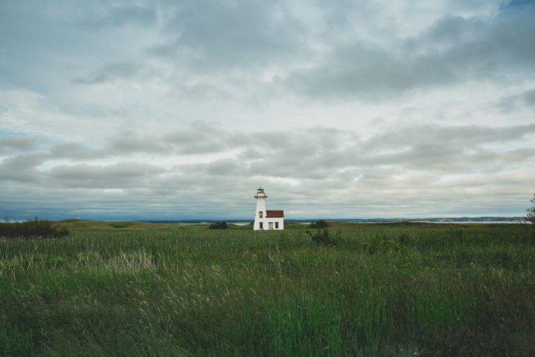
Prince Edward Island is a province and one of the three Maritime Provinces. Maritime means ‘of the sea’. Together, with Newfound and Labrador, these provinces make up the region of Atlantic Canada. PEI is the smallest province of Canada in both land area and population, but it is the most densely populated. The people of…
Nova Scotia is one of Canada’s three Maritime Provinces, and one of the four provinces that form Atlantic Canada. Nova Scotia, which includes Cape Breton Island has over 3,800 coastal islands and a whopping 13,000 plus km of coastline. You can see why most of the population lives and works in a coastal community. The sea…
Discover ice planes and bush planes, the wild Nahanni River or the mammoth Wood Buffalo National Park, and top your tour off with a night show of lights. The Northwest Territories is a federal territory of Canada. At a land area of approximately 1,144,000 km2 , it is the second-largest and the most populous of the…
Pretend passports are a great resource to record places you visit throughout the year through studies and books. Whenever you read a story set in a world location, or study another culture, put a sticker or stamp in your passport for a record of all the places you’ve virtually visited. Class or co-op Group Activity: …
Alberta is a western province of Canada. It is one of only two completely landlocked provinces. It boasts some of the most beautiful locations in Canada, including Banff, and Lake Louise. The 10 day Calgary Stampede is famous around the world. Alberta was named after Princess Louise Caroline Alberta, the fourth daughter of Queen Victoria…
Nunavut is the newest, largest, and most northerly territory of Canada. It was separated officially from the Northwest Territories on April 1, 1999. Nunavut comprises a major portion of Northern Canada, and most of the Canadian Arctic Archipelago. Its vast territory makes it the fifth-largest country subdivision in the world, as well as North America’s…
Prince Edward Island is a province and one of the three Maritime Provinces. Maritime means ‘of the sea’. Together, with Newfound and Labrador, these provinces make up the region of Atlantic Canada. PEI is the smallest province of Canada in both land area and population, but it is the most densely populated. The people of…
Nova Scotia is one of Canada’s three Maritime Provinces, and one of the four provinces that form Atlantic Canada. Nova Scotia, which includes Cape Breton Island has over 3,800 coastal islands and a whopping 13,000 plus km of coastline. You can see why most of the population lives and works in a coastal community. The sea…
Discover ice planes and bush planes, the wild Nahanni River or the mammoth Wood Buffalo National Park, and top your tour off with a night show of lights. The Northwest Territories is a federal territory of Canada. At a land area of approximately 1,144,000 km2 , it is the second-largest and the most populous of the…